- support@husseinkey.com
- livechat
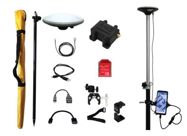
ArduSimple Real-Time Kinematic (RTK) Calibrated Surveyor Kit includes the tools needed for conducting RTK surveys. Real-Time Kinematic positioning is a satellite navigation technique used to enhance the precision of position data derived from the GNSS (Global Navigation Satellite Systems). RTK uses measurements of the phase of the signal’s carrier wave, in addition to the information content of the signal, and relies on a single reference station or interpolated virtual station to provide real-time corrections, providing up to centimeter-level accuracy.
The ArduSimple RTK Calibrated Surveyor Kit makes use of an Android smartphone (not included), connected either by USB OTG or BLUETOOTH®, to collect and interpret the GNSS data.